
On the google maps home page one is greeted with a the United Kingdom, the Republic of Ireland, little bits of France and Norway as well as a lot of blue frame the state. Twice I click on London and the map zooms closer. I repeat this four time, now I have arrived at a map that shows London as a spider's nest, inside what looks at first like a circular river but is in fact a the notorious circular motorway of the M25. Eventually I can see the are of New Cross Road, as bound by the two New Cross train stations.
The map has local businesses advertised, mainly pubs and restaurants. For some of these reviews appear as you hover over them, for example the New Cross Cafe Diner is said to offer 'Good choice of breakfast... if you get your timing right it's full of sexy builders' whilst The Goldsmiths Tavern is said to have 'electric nights'. Clearly this is a limited exploration of the area but at least it does hint at people partaking in social life in the area.
Next I select and drag the little yellow man in the top left corner of the map and drag him to New Cross Gate station.
 On the left we see the image that we are now presented with and this immediately makes shows the place as being a busy place, both for people as well as for traffic. I follow street view along my selected path, each click briefly distorting what I see only for it to show me a new stretch of the north side of the road, complete with people, shops, and traffic. As I keep clicking my way along, at times making use of the various viewing tools that allow me to zoom in and change my angle of perspective I am reminded of the the sci-fi film Blade Runner in which a detective played by Harrison Ford makes use of a similar set of tools. Soon I find myself with a task of my own; to figure out on what day these images were taken. Through zooming in on newsagents shops I eventually find a board which shows the day's Evening Standard headline 'John Leslie Rape Quiz' and a quick google search tells me this is from the 24th of June 2008.
Depending on how I use the tool to scroll through the pictures I can either simulate the idea of me sitting in the backseat of a car that is driving along with the pace of traffic as I am interestedly looking out of the window and thus recreate the journey undertaken by the google car on this day, or by selecting to face not the sidewalk but rather the way of traffic I can get the sensation of myself 'free-running' over cars and buses in a hurried manner.
My impressions of the area are now further shaped by this tool and no doubt for many people this is their first, or perhaps only, experience of this particular part of south east London. Thus great power rests within these images and the way they depict an area and it is in the interests of all who have a particular interest in these places to be aware of how they are depicted.
For the final part of this exercise I click on 'satellite'. Below I have copied and pasted the image that I was then presented with:
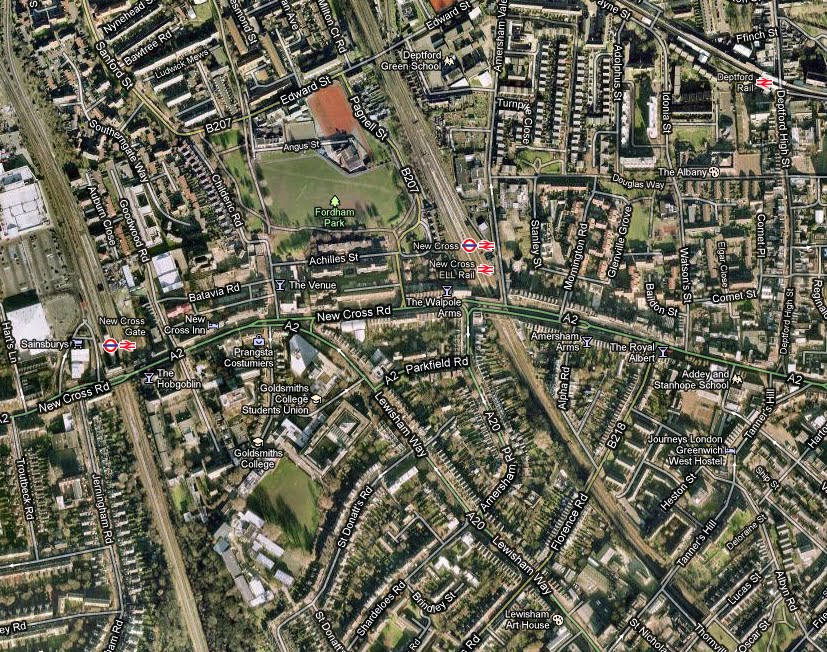 What is immediately of interest here is that if we compare the satellite view to the first map at the top of this post we now see all the empty spaces not occupied by roads filled with houses, trees, large green spaces, and railway lines. So whilst this view serves less well for navigation it does let one know that this is in fact a road that has large park areas as well as streets with impressively sized houses in close proximity. Where this tool was less useful than streetview was when one utilised the zoom function as the image quality was much to low for anything of interest to become visible.
No comments:
Post a Comment